
A case study in the research polygon in Glina and Dvor municipality, Croatia–landslide susceptibility assessment of geological units
Article Sidebar
Main Article Content
Abstract
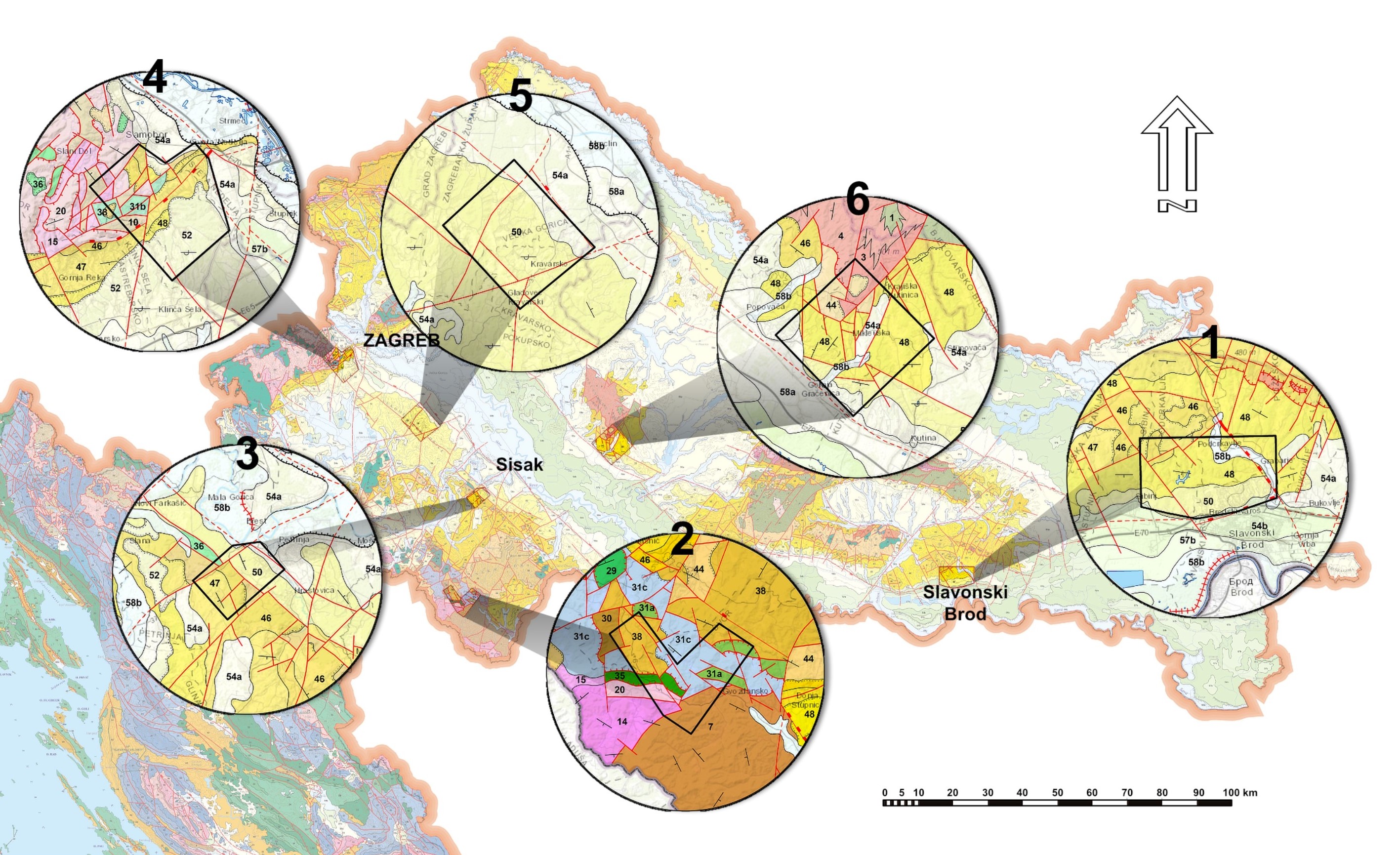
In this paper, a preliminary analysis of the landslide inventory is presented for the wider area of the municipalities of Glina and Dvor, within Sisak-Moslavina County in Croatia, where LiDAR scanning for 45.85 km2 was conducted. Landslide polygons were outlined based on the visual interpretation of HRDEM derivates. In total, 477 landslides were contoured with an average landslide density of 9.85 per km2. Most of the landslides are characterised as moderate, shallow, and not recent. The spatial relationship between landslides and geological units is expressed with the landslide index. Subsequently, the geological units were grouped into four engineering geological units representing different susceptibilities to landslides. The geological units most prone to landslides are the Eocene, Oligocene, Palaeocene and Jurassic sandstones. Even though all geological units were analysed here, the majority of landslides are within sandstones. A particular emphasis was on landslide occurrence in metamorphic and igneous rocks of the ophiolite sequence, a distinctive characteristic of the research area where less susceptibility to landslide processes was observed. Moreover, to further distinguish the differences between the units in the area a morphometric characteristic (relief) and drainage network was also analysed. The purpose of this analysis was to additionally confirm the landslide susceptibility assessment and the division of geological units into engineering geological units, which again implied the different behaviours between landslides in igneous and metamorphic rocks compared to sandstones. Because the research area is poorly studied regarding landslide susceptibility, relief, and drainage networks, these findings will be a step forward in recognising the relationship between them and creating a base for the development of a landslide susceptibility map for this area.
Article Details
Issue
Section
Authors have copyright and publishing rights on all published manuscripts.
References
AHMED, M., F., ROGERS, J., D. & ISMAIL, E., H. (2014): A regional level preliminary landslide susceptibility study of the upper Indus river basin.– European Journal of Remote sensing, 47/1, 343-373. doi: 10.5721/EuJRS20144721
ALLABY, A. & ALLABY, M. (2003): Dictionary of Earth Sciences.– Oxford University Press, UK. 619 p.
ANTONINI, G., CARDINALI, M., GUZZETTI, F., REICHENBACH, P. & SORRENTINO, A. (1993): Carta Inventario dei Fenomeni Franosi della Regione Marche ed aree limitrofe. – CNR, Gruppo Nazionale per la Difesa dalle Catastrofi Idrogeologiche, Publication n. 580, 2 sheets, scale 1:100,000, (in Italian).
BASCH, O. (2009): Paludinske naslage (dacij, romanij – Pl) [Paludine beds – Pl) – in Croatian] – In: VELIĆ, I. & VLAHOVIĆ, I. (eds.): Explanatory note for the Geological Map of the Republic of Croatia 1:300 000. Croatian Geological Survey, Department of Geology, Zagreb, 90-91.
BATHRELLOS, G.D., KALIVAS, D.P.& SKILODIMOU, H.D. (2009): GIS-based landslide susceptibility mapping models applied to natural and urban planning in Trikala, Central Greece.– Estudios Geológicos, 65/1, 49–65. doi: 10.3989/egeol.08642.036
BELL, R., PETSCHKO, H., RÖHRS, M. & DIX, A. (2012): Assessment of landslide age, landslide persistence and human impact using airborne laser scanning digital terrain models.– Geografiska Annaler: Series A, Physical Geography, 94, 135–156. doi: 10.1111/j.1468‐0459.2012.00454.x
BOGNAR, A. (2001): Geomorfološka regionalizacija Hrvatske [Geomorphological sregionalisation of Croatia – in Croatian].– Acta Geographica Croatica, 34, 7–29.
BRABB, E.E., GRAZMER, R.W. & JONES, D.L. (2000): Geologic map and map database of the Palo Alto 30’ X 60’ quadrangle, California.– U.S. Geological Survey Miscellaneous Field Studies Map MF-2332. U.S., Menlo Park, CA.
CONFORTI, M. & IETTO, F. (2020): Influence of Tectonics and Morphometric Features on the Landslide Distribution: A Case Study from the Mesima Basin (Calabria, South Italy).– Journal of Earth Science, 31, 393–409. doi: 10.1007/s12583-019-1231-z
CRUDEN, D.M. & VARNES, D.J. (1996): Landslide types and processes.– In: TURNER, A.K. & SCHUSTER, R.L. (eds.): Landslides, Investigation and Mitigation. Transportation Research Board. Special Report 247, Washington D.C., USA, 36–75.
ČUBRILOVIĆ, P., PALAVESTRIĆ, LJ., NIKOLIĆ, T.& ĆIRIĆ, B. (1967): Inženjerskogeološka karta SFR Jugoslavije 1:500000 [Basic Engineering Geological Map of SFRY 1:500000 – in Croatian].– Savezni geološki zavod, Beograd.
DEMEK, J. (1972): Manual of Detailed Geomorphological Mapping.- Commission on Geomorphological Survey and Mapping, 334 p.
DEMIR, G., AYTEKIN, M., AKGÜN, A.,IKIZLER, S.B.& TATAR, O. (2013): A comparison of landslide susceptibility mapping of the eastern part of the North Anatolian Fault Zone (Turkey) by likelihood–frequency ratio and analytic processes methods. – Natural Hazards, 65, 1481–1506. doi: 10.1007/s11069-012-0418-8
FELL, R., COROMINAS, J.& BONNARD, C. (2008): Guidelines for landslide susceptibility, hazard and risk zoning for land use planning.– Engineering Geology, 102, 85–98. doi: 10.1016/j.enggeo.2008.03.022
GHOSH, S., VAN WESTEN, C.J.&CARRANZA, E.J.M. (2012): Generating eventbased landslidemaps in a data-scarce Himalayan environment for estimating temporal and magnitude probabilities.– Engineering Geology, 128, 49–62. doi: 10.1016/j.enggeo.2011.03.016
GERIĆ, A.(2019): Geomorfološki značaj klizišta sjevernog dijelaKarlovačke županije [Geomorphological significance of landslides in northern part of Karlovac County – in Croatian].– Unpubl. Master Thesis, Faculty of Science, Department of Geography, Univerity of Zagreb, 59 p.
GORETTI, K.K.M. (2010): Landslide occurrence in the hilly areas of Bududa Districts in Eastern Uganda and their causes.– Unpubl. PhD thesis, Makerere University, Department of Geology, Uganda, 106 p.
GUZZETTI, F., CARRARA, A., CARDINAL, M. & REICHENBACH, P. (1999): Landslide hazard evaluation: a review of current techniques and their application in a multi-scale study, Central Italy.– Geomorphology, 31, 181-216. doi: 10.1016/S0169-555X(99)00078-1
GUZZETTI, F., MONDINI, A.C., CARDINALI, M., FIORUCCI, F., SANTANGELO, M. & CHANG, K.T. (2012): Landslide inventory maps: new tools for an old problem.– Earth-Science Reviews, 112, 42–66. doi: 10.1016/j.earscirev.2012.02.001
HEĆIMOVIĆ, I. (2009): Klastične naslage (pliokkvartar – Pl, Q) [Clastic deposits (plioquaternary – Pl, Q) – in Croatian].– In: VELIĆ, I. & VLAHOVIĆ, I. (eds.): Explanatory note for the Geological Map of the Republic of Croatia 1:300 000. Croatian Geological Survey, Department of Geology, Zagreb, 94-95.
HEĆIMOVIĆ, I.& AVANIĆ, R. (2014): Studija potencijala i osnove gospodarenja mineralnim sirovinama Sisačko-moslavačke županije [Study of potenical and basics of minerals resources management in Sisak-Moslavina county– in Croatian].– Unpubl. report, Hrvatski geološki institut, Zagreb, 489 p.
HORTON, R.E. (1945): Erosional development of streams and their drainage basins: hydrophysical approach to quantitative morphology.– Bulletin of the Geological Society of America, 56, 275–370. doi: 10.1177/030913339501900406
HUTCHINSON, J., N. (1995): Landslide hazard assessment.– In: Proceedings VI, International Symposium on Landslides, Christchurch, 1, 1805-1842.
JABOYEDOFF, M., OPPIKOFER, T.& ABELLAN, A., (2010): Use of LIDAR in landslide investigations: a review.– Natural Hazards, 61, 5–28. doi: doi.org/10.1007/s11069-010-9634-2
JAGODNIK, P., JAGODNIK, V., ARBANAS, Ž. & MIHALIĆ ARBANAS, M. (2020): Landslide types in the Slani Potok gully, Croatia.– Geologia Croatica, 73/1, 13–28. doi: 10.4154/gc.2020.04
JURAK, V., MATKOVIĆ, I., MIKLIN, Ž. & CVIJANOVIĆ, D. (1998): Landslide hazard in the Medvednica submountain area under dynamic conditions.– In:MARIĆ, B., LISAC, Z. & SZAVITS-NOSSAN, A (eds.): Geotechnical hazards, XIth Danube-European conference on soil mechanics and geotechnical engineering, Poreč, Croatia.
KEATON, J.R. & DEGRAFF, J.V. (1996): Surface observation and geologic mapping.- In: TURNER, A.K. & SCHUSTER, R.L. (eds.): Landslides – Investigation and Mitigation, National Research Council, Washington, DC, 178–230.
KÖPPEN, W.& WEGENER, A. (1924): The Climates of the Geological Past.- Facsimile of the German original and English translation of Die Klimate der Geologischen Vorzeit, Berlin, Stuttgart.
KUMAR, V., GUPTA, V. & SUNDRYAL, Y.P. (2018): Spatial interrelationship of landslides, litho‐tectonics, and climate regime, Satluj valley, Northwest Himalaya.– Geological Journal, 54, 537–551. doi:10.1002/gj.3204
LEE, S.& TALIB, J.A. (2005): Probabilistic landslide susceptibility and factor effect analysis.– Environmental Geology, 47, 982–990. doi: 10.1007/s00254-005-1228-z
LOZIĆ, S. (1995). Vertikalna raščlanjenost reljefa kopnenog dijela Republike Hrvatske[Vertical relied dissection analysis of the land part of the Reepublic of Croatia – in Croatian].– Acta Geographica Croatica, 30/1, 17–26.
MARKOVIĆ, M. (1983): Osnovi primjenjene geomorfologije[Basis of geomorphology– in Serbian].– Geoinstitut, Oour Istraživanje mineralnih sirovina, inženjerska i hidrogeologija, Beograd, 174 p.
MCCALPIN, J. (1984): Preliminary age classification of landslides for inventory mapping.– Proceedings of the 21st Engineering Geology and Soils Engineering Symposium. ng 2005.
MORADI, S. & REZAEI, M. (2014): A GIS-based comparative study of the analytic hierarchy process, bivariate statistics and frequency ratio methods for landslide susceptibility mapping in part of the Tehran metropolis,
Iran.– Geopersia, 4, 45–61. doi:10.22059/jgeope.2014.51191
MUKHERJEE, S. & JHA, V.,C. (2011): Role of lithology and rock structure in drainage development in the Kaliani river basin, Assam, India.– Ethiopian Journal of Environmental Studies and Management. 4, 2. doi: 10.4314/ejesm.v4i2.7
NENADIĆ, Ž., LOVRIĆ, M., ŠIMOVIĆ, V.& SALOPEK, D. (2010): Zrinska Gora.– Grad Petrinja, Sisačko-moslavačka županija, Sveučilište u Zagrebu, Učiteljski fakultet – Odsjek Petrinja, Matica – Hrvatska – Ogranak Petrinja, 174 p.
NG, K.Y. (2006): Landslide locations and drainage network development: A case study of Hong Kong.– Deomorphology, 76, 229–239. doi: 10.1016/j.geomorph.2005.10.008
NIYAZOV, R. & NURTAEV, B. (2017): The Role of Simultaneous Impact of Exogenousand Endogenous Forces in Landslide ProcessActivation.– In: MIKOS et al. (eds.): Advancing Culture of Living with Landslides. 4th World Landslide Forum Ljubljana, Slovenia.Springer International Publishing AG 2017M. doi: 10.1007/978-3-319-53485-5_2
PAMIĆ, J., GUŠIĆ, I. & JELASKA, V. (1998): Geodynamic evolution of the Central Dinarides.– Tectonophysics, 297, 4; 251–268. doi: 10.1016/S0040-1951(98)00171-1
PAPATHANASSIOU, G., VALKANIOTIS, S. & GANAS, A. (2020): Spatial patterns, controlling factors, and characteristics of landslides triggered by strike-slip faulting earthquakes: case study of Lefkadaisland, Greece.– Bulletin of Engineering Geology and the Environment, 80, 3747-3765. doi: 0.1007/s10064-021-02181-x
PETSCHKO, H. BELL, R. & GLADE, T. (2014): Relative Age Estimation at Landslide Mapping on LiDAR Derivatives: Revealing the Applicability of Land Cover Data in Statistical Susceptibility Modelling.– In: SASSA, K., CANUTI, P. & YIN, Y. (eds.): Landslide Science for a Safer Geoenvironment, Springer, 337–343. doi: 10.1007/978-3-319-05050-8_53
PESHEVSKI, I., JOVANOVSKI, M., ABOLMASOV, B., PAPIĆ, J., ĐURIĆ, U., MAJRANOVIĆ, M., HAQUE, U. & NEDELKOVSKA, N. (2019): Preliminary regional landslide susceptibility assessment using limited data.– Geologia Croatica, 72/1, 81-92. doi: 10.4154/gc.2019.03
PINTARIĆ, L. (2020): Šumski stanišni tipovi Zrinske gore prema Nacionalnoj klasifikaciji staništa i europskim klasifikacijama [Forests of Zrinska Gora Mt. according to National Habitat Classification and European Classifications – in Croatian].– Unpubl. Graduate Thesis,Faculty of Forestry, University of Zagreb, 53 p.
RADIĆ, S. (2019): Clay minerals in Eocene rocks from Hrvatska Kostajnica surroundings.– Unpubl. Seminar III, University of Zagreb, Faculty of Science, 32 p.
REGMI, D.A., YOSHIDA, K., NAGATA, H., PRADHAN, S.M.A., PRADHAN, B.& POURGHASEMI, R.H. (2012): The relationship between geology and rock weathering on the rock instability along Mugling–Narayanghat road corridor, Central Nepal Himalaya.– Natural Hazards, 66, 501–532. doi: 10.1007/s11069-012-0497-6
SCHMID, S.M., BERNOULLI, D., FÜGENSCHUH, B., MATENCO, L., SCHEFER, S., SCHUSTER, R., TISCHLER, M. & USTASZEWSKI, K. (2008): The Alpine-Carpathian- Dinaridic orogenic system: Correlation and evolution of tectonic units.– Swiss Journal of Geosciences, 101/1, 139–183. doi:10.1007/s00015-008-1247-3
SOETERS, R. & VAN WESTEN, C.J. (1996): Slope instability recognition, analysis, and zonation.– In: TURNER, A.K. & SCHUSTER, R.L. (eds.): Landslides, Investigation and Mitigation. Transportation Research Board, Special Report 247, Washington D.C., USA, 129–177.
SOKAČ, B. (2009a): Sajske i kampilske naslage (donji trijas – T1) [Siusi and Campil beds –(Lower Triassic – T1) – in Croatian].– In: VELIĆ, I. & VLAHOVIĆ, I. (eds.): Explanatory note for the Geological Map of the Republic of Croatia 1:300 000. Croatian Geological Survey, Department of Geology, Zagreb, 29–32.
SOKAČ, B. (2009b): Karbonatne naslage (srednji trijas – T2) [Carbonate Deposits (Middle Triassic – T2) – in Croatian].– In: VELIĆ, I. & VLAHOVIĆ, I. (eds.): Explanatory note for the Geological Map of the Republic of Croatia 1:300 000. Croatian Geological Survey, Department of Geology, Zagreb, 32–34.
ŠAPIĆ, I. (2012): Šumska vegetacija Zrinske Gore [Forest Vegetation of Zrinska Gora – in Croatian].– Unpubl. Ph.D. Thesis, Faculty of Forestry, University of Zagreb, 216 p.
ŠESTANOVIĆ, S. (2001): Osnove geologije i petrografije [Fundamentals of geology and petrography – in Croatian].– Sveučilište u Splitu, Građevinski fakultet, 234 p.
ŠIKIĆ, K. (2009a): Klastične i karbonatne naslage (devon, karbon – D, C)[Clastic and carbonate deposits – (Devonian, Carboniferous – D,C) – in Croatian].– In: VELIĆ, I. & VLAHOVIĆ, I. (eds.): Explanatory note for the Geological Map of the Republic of Croatia 1:300 000. Croatian Geological Survey, Department of Geology, Zagreb, 18–19.
ŠIKIĆ, K. (2009b): Ofiolitno-sedimentni kompleks [Ophiolite-sedimentary complex – in Croatian].– In: VELIĆ, I. & VLAHOVIĆ, I. (eds.): Explanatory note for the Geological Map of the Republic of Croatia 1:300 000. Croatian Geological Survey, Department of Geology, Zagreb, 54–54.
ŠIKIĆ, K. (2009c): Metamorfne stijene (srednja–gornja jura – J2,3) [Metamorphic rocks (Middle–Upper Jurassic –J2,3 – in Croatian].– In: VELIĆ, I. & VLAHOVIĆ, I. (eds.): Explanatory note for the Geological Map of the Republic of Croatia 1:300 000. Croatian Geological Survey, Department of Geology, Zagreb, 54–55.
ŠIKIĆ, K. & BERGANT, S. (2009): Hemipelagičke i turbiditne naslage (donja kreda – K1)[Hemipelagic and turbidite beds (Lower Cretaceous – K1 – in Croatian)].– In: VELIĆ, I. & VLAHOVIĆ, I. (eds.): Explanatory note for the Geological Map of the Republic of Croatia 1:300 000. Croatian Geological Survey, Department of Geology, Zagreb, 69–70.
ŠIKIĆ, K., HALAMIĆ, J. & BELAK, M.(2009): Ofiolitne stijene (srednja-gornja jura – J2,3) [Ophiolite rocks (Middle–Upper Jurassic) –J2,3 – in Croatian].– In: VELIĆ, I. & VLAHOVIĆ, I. (eds.): Explanatory note for the Geological Map of the Republic of Croatia 1:300 000. Croatian Geological Survey, Department of Geology, Zagreb, str. 57–60.
ŠIMUNIĆ, AN. (2009): Karbonatni fliš i klastiti (paleocen, eocen – Pc, E) [Carbonate flysch and clastic beds (Paleocene, Eocene – Pc, E)– in Croatian].– In: VELIĆ, I. & VLAHOVIĆ, I. (eds.): Explanatory note for the Geological Map of the Republic of Croatia 1:300 000. Croatian Geological Survey, Department of Geology, Zagreb, 75-76.
ŠPARICA, M., BUKOVAC, J. & BERGANT, S. (2009): Karbonatni klastiti (pretežito fliš) i ‘Scaglia’ vapnenci (gornja kreda – K2) [Carbonate clastic beds (mostly flysch) and ‘Scaglia’ limestones (Upper Cretaceous – K2)– in Croatian].– In: VELIĆ, I. & VLAHOVIĆ, I. (eds.): Explanatory note for the Geological Map of the Republic of Croatia 1:300 000. Croatian Geological Survey, Department of Geology, Zagreb, 70–72.
TIAN, Y., XU, C., CHEN, J., ZHOU, Q. & SHEN, L. (2017): Geometrical characteristics of earthquake-induced landslides and correlations with control factors: a case study of the 2013 Minxian, Gansu, China, Mw 5.9 event.– Landslides, 14, 1915–1927. doi: 10.1007/s10346-017-0835-6
TIBLJAŠ, D. & ŠĆAVNIČAR, S. (1985): Zeoliti u eocenskom konglomeratu kod Velešnje (zapadno od Kostajnice) [Zeolites in Eocene conglomerates from Velešnja (west of Kostajnica) – in Croatian].– Mineralogija, 1, Godišnjak JAM, 207–215.
TIBLJAŠ, D. (1987): Mineraloška istraživanja zeolita iz kenozojskih sedimenata kod Velešnje na Baniji i Donjeg Jesenja u Hrvatskom Zagorju [Mineralogical investigation of zeolites from Cenozoic sediments near Velešnja in Banija and Donje Jesenje in Hrvatsko Zagorje – in Croatian].– Unpubl. MSc. Theses, University of Zagreb, Faculty of Science, 87 p.
TIBLJAŠ, D., TOPALOVIĆ, E. & BALEN, D. (2017a): Clay minerals as thermal history indicators of Inner Dinarides lithologies from the surroundings of Hrvatska Kostajnica (Croatia).- In: XVI International Clay Conference, ICC 2017, Granada, Spain. Scientific Research Abstracts, Vol. 7, Digilabs Pub., Bari,p. 756.
TOPALOVIĆ, E. (2017b): Minerali glina kao indikatori termalnih promjena u stijenama okolice Hrvatske Kostajnice [Clay minerals as indicators of thermal alteration in the rocks in the vicinity of Hrvatska Kostajnica – in Croatian, with English Abstract].– Unpubl Gradutate Thesis. Faculty of Science, University of Zagreb. V+69 p.
THORNTHWAITHE, C. W. (1931): The Climates of North America: According to a New Classification.- Geographical Review, 21, 633-655. doi: 10.2307/209372
TIBLJAŠ, D. (2019): Termalna povijest terena u kredi (kristalinitet illita) [Thermal history of Cretaceous deposits (illite crystallinity) – in Croatian].– Cretaceous GEOdynamic PROOFS in the Dinarides and Pannonian Basin, Project public presentation of results and project outcomes, theme 07, 17 p.
VAN DEN EECKHAUT, M., POESEN, J., VERSTRAETEN, G., VANACKER, V., NYSSEN, J., MOEYERSONS, J., VAN BEEK, L.P.H. & VANDEKERCKHOVE, L. (2007): Use of LIDAR-derived images for mapping old landslides under forest.– Earth Surface Processes and Landforms, 32, 754–769. doi: 10.1002/esp.1417
VAN DEN EECKHAUT, M., HERVÁS, J., JAEDICKE, C., MALET, J.P., MONTANARELLA, L. & NADIM, F. (2012): Statistical modeling of Europe-wide landslide susceptibility using limited landslide inventory data.– Landslides, 9, 357–369. doi: 10.1007/s10346-011-0299-z
VAN WESTEN, C., J., RENGERS, N., TERLIEN, M., T., J. & SOETERS, R. (1997): Prediction of the occurrence of slope instability phenomena through GIS-based hazard zonation.– Geologische Rundschau, 86: 404-414. doi: 10.1007/s005310050149
VAN WESTEN, C.J., RENGERS, N. & SOETERS, R. (2003): Use of geomorphological information in indirect landslide susceptibilitz assesment.– Engineering Geology, 102, 112–131. doi: 10.1007/s10346-011-0299-z
VAN WESTEN, C.J., CASTELLANOS, E. & KURIAKOSE, S.L. (2008): Spatial data for landslide susceptibility, hazard, and vulnerability assessment.– Natural Hazards, 30, 399–419. doi: 10.1023/B:NHAZ.0000007097.42735.9e
VARNES, D.J. (1978): Slope movement types and processes.– In: SCHUSTER. R.L. & KRIZEK R.J. (eds.): Landslides, analysis and control, special report 176. Transportation research board, National Academy of Sciences, Washington, DC., 11–33.
ZHOU, S., CHEN, G., FANG, L. & NIE, Y. (2016): GIS-based integration of subjective and objective weighting methods for regional landslides susceptibility mapping.– Sustainabilty, 8, 334. doi: 10.3390/su8040334