
Tectogenic carbonate breccia (Jelar/Velebit breccia) in the Northern Velebit National Park, SW Croatia: Structural emplacement and breccia lithotypes
Article Sidebar
Main Article Content
Abstract
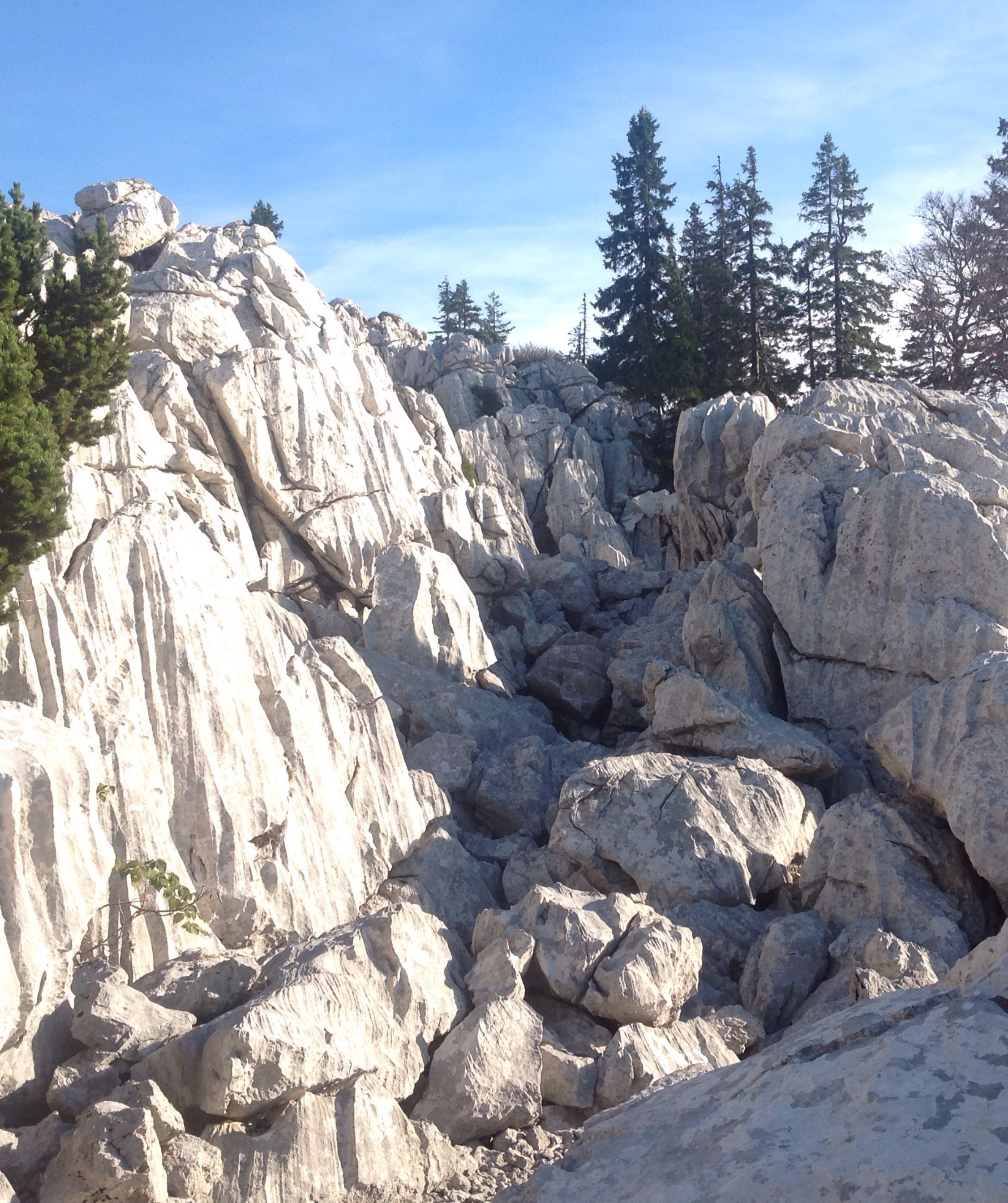
The Velebit Mt. was uplifted by multistage tectonics resulting in the formation of an approximately 150 km long, NW–SE striking anticline comprising a Late Palaeozoic to Cenozoic carbonate-clastic succession, with a major orogenic event in the younger Palaeogene. This study focused on the tectonostratigraphic investigation of a massive Tectogenic carbonate breccia (TCB) studied in the Northern Velebit area, known in the Croatian literature as the Jelar or Velebit breccia. Results of field investigations along eight profiles show that the Northern Velebit represents an ENE-verging fold formed by general E–W (ENE–WSW) contraction in the hangingwall of the NNW–SSE oriented fault, a terminal strand of the NW–SE striking Bakovac Fault Zone. The Palaeogene (–Early Miocene?) and post-Early Miocene tectonic activity resulted in NNW–SSE/ESE–WNW oriented compression, followed by NE–SW and NW–SE extension as a result of the gravitational collapse of the Northern Velebit anticline. N–S and E–W striking dextral/sinistral faults suggest NW–SE/NE–SW and ESE–WNW oriented transpression/transtension in the Northern Velebit area after the Early Miocene. Repeated structural reactivation/tectonic inversion within the Northern Velebit anticline hinge area affected the Jurassic–Cretaceous carbonates, especially along the strike of the fault/fracture systems, which resulted in prolonged brittle deformation, i.e., cataclasis, brecciation, and formation of the TCB. Within the part of the study area marked as carbonate breccia on existing geological maps, on average, 67% of eight studied profiles are actually composed of Upper Jurassic and Cretaceous limestones (and some dolomites). Between those rocks and the TCB typically a transitional zone from metres to a few tens of metres wide can be observed, composed of (1) intensely tectonised limestones/dolomites, and (2) crackle/mosaic carbonate breccia, covering approximately 12% of the total profile length. Tectogenic carbonate breccia in the study area are mostly represented by (3) monomictic carbonate breccia and (4) polymictic carbonate breccia, while (5) carbonate conglomerates and breccia-conglomerates form only rare small lenses. TCB lithotypes crop out along approximately 21% of the profile length marked as carbonate breccia on the existing geological maps of the study area. Most of the TCB outcrops were observed in the central zone of the Northern Velebit, while intensely tectonised limestones, crackle/mosaic carbonate breccia and Upper Jurassic and Cretaceous carbonate rocks predominate in the eastern and western parts.
Article Details
Issue
Section

This work is licensed under a Creative Commons Attribution 4.0 International License.
Authors have copyright and publishing rights on all published manuscripts.
References
ALLMENDINGER, R.W., CARDOZO, N. & FISHER, D.M. (2011): Structural Geology Algorithms: Vectors and Tensors.– Cambridge University Press, 289 p. https://doi.org/10.1017/CBO9780511920202
ALJINOVIĆ, D., ISOZAKI, Y. & SREMAC, J. (2008): The occurrence of giant bivalve Alatoconchidae from the Yabeina zone (Upper Guadalupian, Permian) in European Tethys.– Gondwana Research, 13/3, 275–287. https://doi.org/10.1016/j.gr.2007.09.002
ANGELIER, J. & MECHLER, P. (1977): Sur une methode graphique de recherche des contraintes principales egalement utilisables en tectonique et en seismologie: la methode des diedres droits.– Bulletin de la Société Géologique de France S7-XIX, 1309–1318. https://doi.org/10.2113/gssgfbull.S7-XIX.6.1309
BAHUN, S. (1962): Vapnenci Promina-naslaga u području Kruščice u Lici [Limestones in the Promina deposits of the territory of Kruščica in Lika – in Croatian with English abstract].– Geološki vjesnik 15, 101–106.
BAHUN, S. (1963): Geološki odnosi okolice Donjeg Pazarišta u Lici (trijas i tercijarne Jelar-naslage) [Geological relations of the surroundings of Donje Pazarište in Lika (Croatia) – in Croatian with English abstract].– Geološki vjesnik, 16, 161–170.
BAHUN, S. (1974): Tektonogeneza Velebita i postanak Jelar-naslaga [The tectonogenesis of Mt. Velebit and the formation of Jelar deposits – in Croatian with English abstract].– Geološki vjesnik, 27, 35–51.
BAHUN, S. (1984): The tectonic and hydrogeologic significance of the areas composed of the Jelar formation [Hydrogeological properties of Jelar deposits, Lika (Croatia) – in Croatian with English abstract].– Carsus Iugoslaviae, 11/1, 1–11.
BAHUN, S. (1985): Trijaske naslage i Jelar-formacija u dolini Une između Srba i Brotnje (Hrvatska) [Triassic deposits and Jelar Formation in the Una Valley between Srb and Brotnja (Croatia) – in Croatian with English abstract].– Geološki vjesnik, 38, 21–30.
BALLING, P., GRÜTZNER, C., TOMLJENOVIĆ, B., SPAKMAN, W. & USTASZEWSKI, K. (2021a): Post-collisional mantle delamination in the Dinarides implied from staircases of Oligo-Miocene uplifted marine terraces.– Scientific Reports, 11, 2685, 1–12. https://doi.org/10.1038/s41598-021-81561-5
BALLING, P., TOMLJENOVIĆ, B., SCHMID, S.M. & USTASZEWSKI, K. (2021b): Contrasting along-strike deformation styles in the central External Dinarides assessed by balanced cross-sections: Implications for the tectonic evolution of its Paleogene flexural foreland basin system.– Global and Planetary Change, 205, 103587, 1–24. https://doi.org/10.1016/j.gloplacha.2021.103587
BALLING, P., TOMLJENOVIĆ, B., HERAK, Ma. & USTASZEWSKI, K. (2023): Impact of mechanical stratigraphy on deformation style and distribution of seismicity in the central External Dinarides: a 2D forward kinematic modelling study.– Swiss Journal of Geosciences, 116/7, 30 p. https://doi.org/10.1186/s00015-023-00437-0
BOGNAR, A., FAIVRE, S. & PAVELIĆ, J. (1991): Tragovi oledbe na Sjevernom Velebitu ?Glaciation traces on the North Velebit – in Croatian with English abstract ?.– Croatian Geographical Bulletin, 53, 27–38.
CAPORALI, A., AICHHORN, C., BARLIK, M., BECKER, M., FEJES, I., GERHATOVA, L., GHITAU, D., GRENERCZY, G., HEFTY, J., KRAUSS, S., MEDAK, D., MILEV, G., MOJZES, M., MULIC, M., NARDO, A., PESEC, P., RUS, T., SIMEK, J., SLEDZINSKI, J., SOLARIC, M., STANGL, G., STOPAR, B., VESPE, F. & VIRAG, G. (2009): Surface kinematics in the Alpine–Carpathian–Dinaric and Balkan region inferred from a new multi-network GPS combination solution.– Tectonophysics, 474, 295–321. https://doi.org/10.1016/j.tecto.2009.04.035
CARDOZO, N. & ALLMENDINGER, R.W. (2013): Spherical projections with OSXStereonet.– Computers and Geosciences, 51, 193–205. https://doi.org/10.1016/j.cageo.2012.07.021
CRNOLATAC, I. & MILAN, A., (1959): Prilog poznavanju Prominskih naslaga Like ?Ein Beitrag zur Kenntnis der Prominaschichten in der Lika – in Croatian with German abstract)?.– Geološki vjesnik, 12, 49–52.
CVIJIĆ, J. (1893): Das Karstphänomen: Versuch einer Morphologischen Monographie.– Hölzel, Wien.
D'AGOSTINO, N., AVALLONE, A., CHELONI, D., D'ANASTASIO, E., MANTENUTO, S. & SELVAGGI, G. (2008): Active tectonics of the Adriatic region from GPS and earthquake slip vectors.– Journal of Geophysical Research–Solid Earth, 113, B12: B12413. https://doi.org/10.1029/2008JB005860
DOBLAS, M. (1998): Slickenside kinematic indicators.– Tectonophysics, 295, 187–197. https://doi.org/10.1016/S0040-1951(98)00120-6
FIO, K., SPANGENBERG, J.E., VLAHOVIĆ, I., SREMAC, J., VELIĆ, I. & MRINJEK, E. (2010): Stable isotope and trace element stratigraphy across the Permian–Triassic transition: A redefinition of the boundary in the Velebit Mountain, Croatia.– Chemical Geology, 278/1–2, 38–57. https://doi.org/10.1016/j.chemgeo.2010.09.001
FLUDE, S., BOND C.E. & BUTLER, R.W.H. (2025): Are geological description practices and classification schemes fit for future use? Breccias as an example.– Earth-Science Reviews, 266, 105140. https://doi.org/10.1016/j.earscirev.2025.105140
FMS-DATABASE (2019): Database of Focal Mechanism Solutions.– Unpublished report, Department of Geophysics, Faculty of Science, University of Zagreb.
FRITZ, F. & PAVIČIĆ, A. (1975): Tektonski odnosi u području krednih i Jelar naslaga (tercijar) kod Kosinja u Lici ?Tectonical pattern of Cretaceous and Jelar deposits (Tertiary) at Kosinj, Lika (Croatia) – in Croatian with English abstract?.– Geološki vjesnik, 28, 35–42.
FRITZ, F., BAHUN, S. & PAVIČIĆ, A. (1978): Tektonski okvir karbonatnih klastita u području Zrmanje uzvodno od Obrovca ?Tectonic setting of carbonate clastic sediments in the area of river Zrmanja upstream of Obrovac – in Croatian with English abstract?.– Carsus Iugoslaviae, 9, 273–282.
GOVORČIN, M., HERAK, Ma., MATOŠ, B., PRIBIČEVIĆ, B. & VLAHOVIĆ, I. (2020): Constraints on complex faulting during the 1996 Ston–Slano (Croatia) earthquake inferred from the DInSAR, seismological and geological observations.– Remote Sensing, 12, 1157. https://doi.org/10.3390/rs12071157
GRENERCZY, G., SELLA, G., STEIN, S. & KENYERES, A. (2005): Tectonic implications of the GPS velocity field in the northern Adriatic region.– Geophysical Research Letters, 32, L16311. https://doi.org/10.1029/2005GL022947
GRIMANI, I., ŠIKIĆ, K. & ŠIMUNIĆ, A. (1972): Osnovna geološka karta SFRJ 1:100 000, list Knin L 33-141 ?Basic Geological Map of SFRY 1:100 000, Knin sheet L 33-141 – in Croatian].– Institut za geološka istraživanja, Zagreb, Savezni geološki zavod, Beograd.
GRIMANI, I., ŠUŠNJAR, M., BUKOVAC, J., MILAN, A., NIKLER, L., CRNOLATAC, I., ŠIKIĆ, D. & BLAŠKOVIĆ, I. (1973): Osnovna geološka karta SFRJ 1:100 000. Tumač za list Crikvenica L 33-102 [Basic Geological Map of SFRY 1:100 000. Explanatory notes for the Crikvenica sheet L 33-102 – in Croatian].– Institut za geološka istraživanja, Zagreb, Savezni geološki zavod, Beograd, 47 p.
GRIMANI, I., JURIŠA, M., ŠIKIĆ, K. & ŠIMUNIĆ, A. (1975): Osnovna geološka karta SFRJ 1:100 000. Tumač za list Knin L 33-141 [Basic Geological Map of SFRY 1:100 000. Explanatory notes for the Knin sheet L 33-141 – in Croatian].– Institut za geološka istraživanja, Zagreb, Savezni geološki zavod, Beograd, 61 p.
HERAK, Mi. (1959): Geologija Gračačkog polja u Lici.– Geološki vjesnik, 13, 31–56.
HERAK, Mi. & BAHUN, S. (1979): The role of the calcareous breccias (Jelar Formation) in the tectonic interpretation of the High Karst Zone of the Dinarides ?Uloga vapnenačkih breča (Jelar formacija) u tektonskoj interpretaciji Zone visokog krša u Dinaridima?.– Geološki vjesnik, 31, 49–59.
HERAK, Ma. & HERAK, D. (2018): On earthquake locations using the source-specific station corrections in the Kvarner–Velebit region, Croatia.– In: 36th General Assembly of the European Seismological Commission: Book of Abstracts. University of Malta, Valletta, 486–486.
HERAK, D., HERAK, Ma., PRELOGOVIĆ, E., MARKUŠIĆ, S. & MARKULIN, Ž. (2005): Jabuka island (Central Adriatic Sea) earthquakes of 2003.– Tectonophysics, 397, 167–180. https://doi.org/10.1016/j.tecto.2005.01.007
ISOZAKI, Y., ALJINOVIĆ, D. & KAWAHATA, H. (2011): The Guadalupian (Permian) Kamura event in European Tethys.– Palaeogeography, Palaeoclimatology, Palaeoecology, 308/1–2, 12–21. https://doi.org/10.1016/j.palaeo.2010.09.034
IVANOVIĆ, A., VELIĆ, I., SOKAČ, B. & NIKLER, L. (1965): Geologija područja zapadno od Krbavskog polja [Geology of the area west of Krbavsko polje; in Croatian].– Carsus Iugoslaviae, 2, 13–26.
IVANOVIĆ, A., SAKAČ, K., MARKOVIĆ, S., SOKAČ, B., ŠUŠNJAR, M., NIKLER, L. & ŠUŠNJARA, A. (1973): Osnovna geološka karta SFRJ 1:100 000, list Obrovac L 33-140 [Basic Geological Map of SFRY 1:100 000, Obrovac sheet L 33-140 – in Croatian].– Institut za geološka istraživanja, Zagreb, Savezni geološki zavod, Beograd.
IVANOVIĆ, A., SAKAČ, K., SOKAČ, B., VRSALOVIĆ-CAREVIĆ, I. & ZUPANIČ, J. (1976): Osnovna geološka karta SFRJ 1:100 000. Tumač za list Obrovac L 33-140 [Basic Geological Map of SFRY 1:100 000. Explanatory notes for the Obrovac sheet L 33-140 – in Croatian].– Institut za geološka istraživanja, Zagreb, Savezni geološki zavod, Beograd, 61 p.
IVANOVIĆ, A., SIKIRICA, V., MARKOVIĆ, V. & SAKAČ, K. (1977): Osnovna geološka karta SFRJ 1:100 000, list Drniš K 33-9 [Basic Geological Map of SFRY 1:100 000, Drniš sheet K 33-9 – in Croatian].– Institut za geološka istraživanja, Zagreb, Savezni geološki zavod, Beograd.
IVANOVIĆ, A., SIKIRICA, V. & SAKAČ, K. (1978): Osnovna geološka karta SFRJ 1:100 000. Tumač za list Drniš K 33-9 [Basic Geological Map of SFRY 1:100 000. Explanatory notes for the Drniš sheet K 33-9 – in Croatian].– Institut za geološka istraživanja, Zagreb, Savezni geološki zavod, Beograd, 59 p.
KASTELIC, V., VANNOLI, P., BURRATO, P., FRACASSI, U., TIBERTI, M.M. & VALENSISE, G. (2013): Seismogenic sources in Adriatic Domain.– Marine Petroleum Geology, 42, 181–213. https://doi.org/10.1016/j.marpetgeo.2012.08.002
KOCH, F. (1929): Geološka karta Hrvatske, Slavonije i Dalmacije (prilog geološkoj karti Kraljevine Srba, Hrvata i Slovenaca) Karlobag–Jablanac (Zone 27, Col. XII).– Naklada Geol. zav. u Zagrebu. Repr. Vojno geogr. Inst., Beograd.
KORBAR, T. (2009): Orogenic evolution of the External Dinarides in the NE Adriatic region: A model constrained by tectonostratigraphy of Upper Cretaceous to Paleogene carbonates.– Earth-Science Reviews, 96, 296–312. https://doi.org/10.1016/j.earscirev.2009.07.004
KORBAR, T. (2025): Conflicting tectonic interpretations of the central External Dinarides.– Geologia Croatica, 78/3, 257–265. https://doi.org/10.4154/gc.2025.17
LACKOVIĆ, D. (1993): Lukina jama u sjevernom Velebitu – najdublja jama u Hrvatskoj.– Vijesti Hrvatskog geološkog društva, 30, 83–85.
LI, Y., HOU, G., HARI, K.R., NENG, Y., LEI, G., TANG, Y., ZHOU, L., SUN, S. & ZHENG, C. (2018): The model of fracture development in the faulted folds: The role of folding and faulting.– Marine and Petroleum Geology, 89, 243–251. https://doi.org/10.1016/j.marpetgeo.2017.05.025
MAJCEN, Ž. & KOROLIJA, B. (1973): Osnovna geološka karta SFRJ 1:100 000. Tumač za list Zadar L 33-139 [Basic Geological Map of SFRY 1:100 000. Explanatory notes for the Zadar sheet L 33-139 – in Croatian].– Institut za geološka istraživanja Zagreb, Savezni geološki zavod, Beograd, 44 p.
MAJCEN, Ž., KOROLIJA, B., SOKAČ, B. & NIKLER, L. (1970): Osnovna geološka karta SFRJ 1:100 000, list Zadar L 33-139 [Basic Geological Map of SFRY 1:100 000, Zadar sheet L 33-139 – in Croatian].– Institut za geološka istraživanja, Zagreb, Savezni geološki zavod, Beograd.
MAMUŽIĆ, P. & MILAN, A. (1973): Osnovna geološka karta SFRJ 1:100 000. Tumač za list Rab L 33-114 [Basic Geological Map of SFRY 1:100 000. Explanatory notes for the Rab sheet L 33-114 – in Croatian].– Institut za geološka istraživanja, Zagreb, Savezni geološki zavod, Beograd, 39 p.
MAMUŽIĆ, P. & SOKAČ, B. (1973): Osnovna geološka karta SFRJ 1:100 000. Tumač za listove Silba i Molat L 33-126 i L 33-138 [Basic Geological Map of SFRY 1:100 000. Explanatory notes for the Silba and Molat sheet L 33-126 and L 33-138 – in Croatian].– Institut za geološka istraživanja, Zagreb, Savezni geološki zavod, Beograd, 45 p.
MAMUŽIĆ, P., MILAN, A., KOROLIJA, B., BOROVIĆ, I. & MAJCEN, Ž. (1969): Osnovna geološka karta SFRJ 1:100 000, list Rab L 33-114 [Basic Geological Map of SFRY 1:100 000, Rab sheet L 33-114 – in Croatian].– Institut za geološka istraživanja, Zagreb, Savezni geološki zavod, Beograd.
MAMUŽIĆ, P., SOKAČ, B. & VELIĆ, I. (1970): Osnovna geološka karta SFRJ 1:100 000, list Silba L 33-126 [Basic Geological Map of SFRY 1:100 000, Silba sheet L 33-126 – in Croatian].– Institut za geološka istraživanja, Zagreb, Savezni geološki zavod, Beograd.
MARINČIĆ, S., KOROLIJA, B. & MAJCEN, Ž. (1976): Osnovna geološka karta SFRJ 1:100 000, list Omiš K 33-22 [Basic Geological Map of SFRY 1:100 000, Omiš sheet K 33-22 – in Croatian].– Institut za geološka istraživanja, Zagreb, Savezni geološki zavod, Beograd.
MARINČIĆ, S., KOROLIJA, B., MAMUŽIĆ, P., MAGAŠ, N., MAJCEN, Ž., BRKIĆ, M. & BENČEK, Đ. (1977): Osnovna geološka karta SFRJ 1:100 000. Tumač za list Omiš K 33-22 [Basic Geological Map of SFRY 1:100 000. Explanatory notes for the Omiš sheet K 33-22– in Croatian].– Institut za geološka istraživanja Zagreb, Savezni geološki zavod, Beograd, 51 p.
MARRETT, R. & ALLMENDINGER, R.W. (1990): Kinematic analysis of fault-slip data. Journal of Structural Geology 12, 973–986. https://doi.org/10.1016/0191-8141(90)90093-E
MATEŠIĆ, D., MATOŠ, B., BILLI, A., SMERAGLIA, L., FABBI, S., BALAIĆ, L. & VLAHOVIĆ, I. (2023): Cenozoic massive carbonate breccia in the External Dinarides of Croatia: The largest outcrop on the island of Krk.– In: VLAHOVIĆ, I. & MATEŠIĆ, D. (eds.): 36th IAS Meeting of Sedimentology: Abstracts Book. Croatian Geological Society, Zagreb, 517–517.
MÉTOIS, M., D’AGOSTINO, N., AVALLONE, A., CHAMOT-ROOKE, N., RABAUTE, A., DUNI, L., KUKA, N., KOCI, R. & GEORGIEV, I. (2015): Insights on continental collisional processes from GPS data: Dynamics of the peri-Adriatic belts.– Journal of Geophysical Research: Solid Earth, 120, 8701–8719. https://doi.org/10.1002/2015JB012023
MORT, K. & WOODCOCK, N.H. (2008): Quantifying fault breccia geometry: Dent Fault, NW England.– Journal of Structural Geology, 30, 701–709. https://doi.org/10.1016/j.jsg.2008.02.005
MRINJEK, E. (1993): Sedimentology and depositional settings of alluvial Promina beds in Northern Dalmatia, Croatia.– Geologia Croatica, 46/2, 243–261.
ORTNER, H., REITER, F. & ACS, P. (2002): Easy handling of tectonic data: the programs TectonicVB for Mac and TectonicsFP for WindowsTM.– Computers & Geosciences, 28, 1193–1200. https://doi.org/10.1016/S0098-3004(02)00038-9
PALENIK, D., MATIČEC, D., FUČEK, L., MATOŠ, B., HERAK, Ma. & VLAHOVIĆ, I. (2019): Geological and structural setting of the Vinodol Valley (NW Adriatic, Croatia): Insights into its tectonic evolution based on structural investigations.– Geologia Croatica, 72, 179–193. https://doi.org/10.4154/gc.2019.13
POLŠAK, A. (1957): Nova nalazišta Prominskih klastičnih sedimenata u Hrvatskom Primorju ?Neue Fundorte klastischer Prominasedimente in Hrvatsko primorje (im Kroatischen Küstenland) – in Croatian with German abstract?.– Geološki vjesnik, 10, 91–103.
POLŠAK, A., JURIŠA, M., ŠPARICA, M. & ŠIMUNIĆ, A. (1976): Osnovna geološka karta SFRJ 1:100 000, list Bihać L 33-116 [Basic Geological Map of SFRY 1:100 000, Bihać sheet L 33-116 – in Croatian].– Institut za geološka istraživanja, Zagreb, Savezni geološki zavod, Beograd.
POLŠAK, A., CRNKO, J., ŠIMUNIĆ, An., ŠIMUNIĆ, Al., ŠPARICA, M. & JURIŠA, M. (1978): Osnovna geološka karta SFRJ 1:100 000. Tumač za list Bihać L 33-128 [Basic Geological Map of SFRY 1:100 000. Explanatory notes for the Bihać sheet L 33-128 – in Croatian].– Institut za geološka istraživanja, Zagreb, Savezni geološki zavod, Beograd, 52 p.
POLJAK, J. (1938): Promina naslage Velebita i Like.– Vesnik Geološkog Instituta Kraljevine Jugoslavije, 25–33.
PRELOGOVIĆ, E., ALJINOVIĆ, B. & BAHUN, S. (1995): New data on structural relationships in the Northern Dalmatian Dinaride Area.– Geologia Croatica, 48/2, 167–176.
PRELOGOVIĆ, E., PRIBIČEVIĆ, B., IVKOVIĆ, Ž., DRAGIČEVIĆ, I., BULJAN, R. & TOMLJENOVIĆ, B. (2004): Recent structural fabric of the Dinarides and tectonically active zones important for petroleum-geological exploration in Croatia.– Nafta, 55/4, 155–161.
RAMOVŠ, A., HINTERLECHNER-RAVNIK, A., KALENIĆ, M., KARAMATA, S., KOCHANSKY-DEVIDÉ, V., KRSTIĆ, B., KULENOVIĆ, E., MIRKOVIĆ, M., PETKOVSKY, P., SREMAC, J. & TEMKOVA, V. (1990): Stratigraphic correlation forms of the Yugoslav Paleozoic.− Rendiconti della Società Geologica Italiana, 12, 359−383.
RAMSAY, J.G. & HUBER, M. (1987): The Techniques of Modern Structural Geology, Vol. 2: Folds and Fractures.– Academic Press, London, 445–473.
ROGLIĆ, J. (1963): Glaciation of the Dinaric mountains and its effects on the Karst.– In: Report of the 6th International Congress on Karst, Warsaw 1961. Lodź, Panstwowe Wydawnictwo Naukowe, 293–299.
SAKAČ, K., BENIĆ, J., BAHUN, S. & PENCINGER, V. (1993a): Stratigraphic and tectonic position of Paleogene Jelar beds in the Outer Dinarides.– Natura Croatica, 55–72.
SAKAČ, K., ŠINKOVEC, B., DURN, G. & BENIĆ, J. (1993b): Boksiti i Jelar- naslage ?The bauxites and Jelar-Beds – in Croatian with English abstract?.– Rudarsko-geološko-naftni zbornik, 5, 59–64.
SARIKAYA, M.A., STEPIŠNIK, U., ŽEBRE, M., ÇINER, A., YILDIRIM, C., VLAHOVIĆ, I., TOMLJENOVIĆ, B., MATOŠ, B. & WILCKEN, K.M. (2020): Last glacial maximum deglaciation of the Southern Velebit Mt. (Croatia): insights from cosmogenic 36Cl dating of Rujanska Kosa.– Mediterranean Geoscience Reviews, 2, 53–64. https://doi.org/10.1007/s42990-020-00030-9
SCHMID, S.M., BERNOULLI, D., FÜGENSCHUH, B., MATENCO, L., SCHEFER, S., SCHUSTER, R., TISCHLER, M. & USTASZEWSKI, K. (2008): The Alpine–Carpathian–Dinaridic orogenic system: Correlation and evolution of tectonic units.– Swiss Journal of Geosciences, 101/1, 139–183. https://doi.org/10.1007/s00015-008-1247-3
SCHMID, S.M., FÜGENSCHUH, B., KOUNOV, A., MAŢENCO, L., NIEVERGELT, P., OBERHÄNSLI, R., PLEUGER, J., SCHEFER, S., SCHUSTER, R., TOMLJENOVIĆ, B., USTASZEWSKI, K., VAN HINSBERGEN, D.J.J. (2020): Tectonic units of the Alpine collision zone between Eastern Alps and western Turkey.– Gondwana Research, 78, 308–374. https://doi.org/10.1016/j.gr.2019.07.005
SCHUBERT, R.J. (1908): Geologische Spezialkarte der im Reichsrate vertrenen Königreiche und Länder der Österreichisch–Ungarischen Monarchie. Novegradi und Benkovac, 1:75.000 (Zone 29 Col. XIII).– Geol Reichanst., Wien.
SCHUBERT, R.J. (1909): Geologische Spezialkarte der im Reichsrate vertrenen Königreiche und Länder der Österreichisch–Ungarischen Monarchie neu afgennomen und herausgeben durch die k. k. Geologische Reichanstalt. Medak und Sv. Rok, 1:75.000 (Zone 28 Col. XIII).– Geol Reichanst., Wien.
SCHUBERT, R.J. (1920a): Geologische Spezialkarte der im Reichsrate vertrenen Königreiche und Länder der Österreichisch–Ungarischen Monarchie. Knin und Ervenik, 1:75.000 (Zone 29 Col. XIV).– Geol Reichanst., Wien.
SCHUBERT, R.J. (1920b): Geologische Spezialkarte der im Reichsrate vertrenen Königreiche und Länder der Österreichisch–Ungarischen Monarchie. Zara, 1:75.000 (Zone 29 Col. XII).– Geol Reichanst., Wien.
SCHUBERT, R.J. & WAAGEN, L. (1912): Geologische Spezialkarte der im Reichsrate vertrenen Königreiche und Länder der Österreichisch–Ungarischen Monarchie neu afgennomen und herausgeben durch die k. k. Geologische Reichanstalt. Pago, 1:75.000 (Zone 28 Col. XII, SW-Gruppe Nr. 115).– Geol Reichanst., Wien.
SMIRČIĆ, D., KOLAR-JURKOVŠEK, T., ALJINOVIĆ, D., BARUDŽIJA, U., JURKOVŠEK, B. & HRVATOVIĆ, H. (2018): Stratigraphic definition and correlation of Middle Triassic volcaniclastic facies in the External Dinarides: Croatia and Bosnia and Herzegovina.– Jornal of Earth Sciences, 29, 310 864–878. https://doi.org/10.1007/s12583-018-0789-1
SMIRČIĆ, D., ALJINOVIĆ, D., BARUDŽIJA, U. & KOLAR-JURKOVŠEK, T. (2020): Middle Triassic syntectonic sedimentation and volcanic influence in the central part of the External Dinarides, Croatia (Velebit Mts.).– Geological Quarterly, 64, 220–239. https://doi.org/10.7306/gq.1528
SOKAČ, B., NIKLER, L., VELIĆ, I. & MAMUŽIĆ, P. (1974): Osnovna geološka karta SFRJ 1:100 000, list Gospić L 33-127 [Basic Geological Map of SFRY 1:100 000, Gospić sheet L 33-127 – in Croatian].– Institut za geološka istraživanja, Zagreb, Savezni geološki zavod, Beograd.
SOKAČ, B., BAHUN, S., VELIĆ, I. & GALOVIĆ, I. (1976a): Osnovna geološka karta SFRJ 1:100 000. Tumač za list Otočac L 33-115 [Basic Geological Map of SFRY 1:100 000. Explanatory notes for the Otočac sheet L 33-115 – in Croatian].– Institut za geološka istraživanja, Zagreb, Savezni geološki zavod, Beograd, 44 p.
SOKAČ, B., ŠČAVNIČAR, I. & VELIĆ, I. (1976b): Osnovna geološka karta SFRJ 1:100 000. Tumač za list Gospić L 33-127 [Basic Geological Map of SFRY 1:100 000. Explanatory notes for the Gospić sheet – in Croatian].– Institut za geološka istraživanja, Zagreb, Savezni geološki zavod, Beograd, 64 p.
SOKAČ, B., ŠUŠNJAR, M., BUKOVAC, J. & BAHUN, S. (1976c): Osnovna geološka karta SFRJ 1:100 000. Tumač za list Udbina L 33-128 [Basic Geological Map of SFRY 1:100 000. Explanatory notes for the Udbina sheet – in Croatian].– Institut za geološka istraživanja, Zagreb, Savezni geološki zavod, Beograd, 62 p.
STEPIŠNIK, U., STOJILKOVIĆ, B. & HOČEVAR, G. (2019): Geomorfološke značilnosti Severnega Velebita [in Slovenian].– In: STEPIŠNIK, U. (ed.): Dinarski kras: Severni Velebit. Ljubljana, Znanstvena založba Filozofske fakultete, 21–43.
STROJ, A. (2004): Speleomorfološke značajke i geneza jamskog sustava Velebita – Dva Javora ?Speleo-morphological features and the genesis of the cave system Velebita – Dva Javora – in Croatian with English abstract?.– Speleolog, 34, 11–17.
STROJ, A. & VELIĆ, I. (2015): Geološki profil Jamskog sustava Lukina Jama– Trojama na Sjevernom Velebitu.– In: HORVAT, M. & WACHA, L. (eds.): 5th Croatian Geological Congress: Abstracts Book. Zagreb, Croatian Geological Survey, 240–241.
ŚRODOŃ, J., ANCZKIEWICZ, A.A., DUNKL, I., VLAHOVIĆ, I., VELIĆ, I., TOMLJENOVIĆ, B., KAWIAK, T., BANAŚ, M. & VON EYNATTEN, H. (2018): Thermal history of the central part of the Karst Dinarides, Croatia: combined application of clay mineralogy and low-T thermochronology.– Tectonophysics, 744, 155–176, https://doi.org/10.1016/j.tecto.2018.06.016
ŠUŠNJAR, M., BUKOVAC, J., NIKLER, L., CRNOLATAC, I., MILAN, A., ŠIKIĆ, D., GRIMANI, I., VULIĆ, Ž. & BLAŠKOVIĆ, I. (1970): Osnovna geološka karta SFRJ 1:100 000, list Crikvenica L 33-102 [Basic Geological Map of SFRY 1:100 000, Crikvenica sheet L 33-102 – in Croatian].– Institut za geološka istraživanja, Zagreb, Savezni geološki zavod, Beograd.
ŠUŠNJAR, M., SOKAČ, B., BAHUN, S., BUKOVAC, J., NIKLER, L. & IVANOVIĆ, A. (1973): Osnovna geološka karta SFRJ 1:100.000, list Udbina L 33-128 [Basic Geological Map of SFRY 1:100,000, Udbina sheet L 33-128 – in Croatian].– Institut za geološka istraživanja, Zagreb, Savezni geološki zavod, Beograd.
TARI, V. (2002): Evolution of the northern and western Dinarides: a tectonostratigraphic approach.– EGU Stephan Mueller Special Publication Series, 1, 223–236. https://doi.org/10.5194/smsps-1-223-2002
TARI KOVAČIĆ, V. & MRINJEK, E. (1994): The role of Palaeogene clastics in the tectonic interpretation of Northern Dalmatia (Southern Croatia).– Geologia Croatica, 47/1, 127–138.
TAVANI, S., STORTI, F., BAUSÀ, J. & MUÑOZ, A. (2012): Late thrusting extensional collapse at the mountain front of the northern Apennines (Italy).– Tectonics, 31, TC4019, 1‒17. https://doi.org/10.1029/2011TC003059
TIŠLJAR, J., VLAHOVIĆ, I., VELIĆ, I. & SOKAČ, B. (2002): Carbonate platform megafacies of the Jurassic and Cretaceous deposits of the Karst Dinarides.– Geologia Croatica, 55/2, 139–170.
TOMLJENOVIĆ, B., BALLING, P., MATOŠ, B., VLAHOVIĆ, I., HERAK, Ma., HERAK, D., BLAŽOK, L., POSARIĆ, D., ŠIROL, A., SCHMID, S.M. & USTASZEWSKI, K. (2017): Kinematic analysis of outcrop-scale joint and fault systems in the Velebit Mt. – implication to tectogenesis and active seismo-tectonics.– In: MARJANAC, Lj. (ed.): 5th Regional Scientific Meeting on Quaternary Geology dedicated to Geological Hazards & Final Conference: LoLADRIA project. Zagreb, Croatian Academy of Sciences and Arts, 69–70.
TURNER, F.J. (1953): Nature and dynamic interpretation of deformation lamellae in calcite of three marbles.– American Journal of Science, 251, 276–298. https://doi.org/10.2475/ajs.251.4.276
TWISS, R.J. & MOORES, E.M. (1992): Structural Geology.– W.H. Freeman and Company, New York, 532 p.
USTASZEWSKI, K., HERAK, Ma., TOMLJENOVIĆ, B., HERAK, D. & MATEJ, S. (2014): Neotectonics of the Dinarides–Pannonian Basin transition and possible earthquake sources in the Banja Luka epicentral area.– Journal of Geodynamics, 82, 52–68. https://doi.org/10.1016/j.jog.2014.04.006
VELIĆ, I. & SOKAČ, B. (1981): Osnovna geološka karta SFRJ 1:100 000, list Ogulin L 33-103 [Basic Geological Map of SFRY 1:100 000, Ogulin sheet L 33-103 – in Croatian].– Geološki zavod – OOUR za geologiju i paleontologiju, Zagreb, Savezni geološki zavod, Beograd.
VELIĆ, I., BAHUN, S., SAKAČ, B. & GALOVIĆ, I. (1974): Osnovna geološka karta SFRJ 1:100 000, list Otočac L 33-115 [Basic Geological Map of SFRY 1:100 000, Otočac sheet L 33-115 – in Croatian].– Institut za geološka istraživanja, Zagreb, Savezni geološki zavod, Beograd.
VELIĆ, I., SOKAČ, B. & ŠĆAVNIČAR, B. (1982): Osnovna geološka karta SFRJ 1:100 000. Tumač za list Ogulin L 33-103 [Basic Geological Map of SFRY 1:100,000. Explanatory notes for the Ogulin sheet L 33-103 – in Croatian].– Institut za geološka istraživanja, Zagreb, Savezni geološki zavod, Beograd, 44 p.
VELIĆ, J., VELIĆ, I. & KLJAJO, D. (2011): Sedimentary bodies, forms and occurences in the Tudorevo and Mirovo glacial deposits of northern Velebit (Croatia).– Geologia Croatica, 64/1, 1–16. https://doi.org/10.4154/GC.2011.01
VELIĆ, J., VELIĆ, I., KLJAJO, D., PROTRKA, K., ŠKRABIĆ, H. & ŠPOLJAR, Z.A. (2017): Geological overview of glacial accumulation and erosional occurrences on the Velebit and the Biokovo Mts., Croatia.– Rudarsko- geološko-naftni zbornik, 32/4, 77–96. https://doi.org/10.17794/rgn.2017.4.8
VLAHOVIĆ, I., TIŠLJAR, J., VELIĆ, I. & MATIČEC, D. (2005): Evolution of the Adriatic Carbonate Platform: Paleogeography, main events and depositional dynamics.– Palaeogeography, Palaeoclimatology, Palaeoecology, 220, 333–360. https://doi.org/10.1016/j.palaeo.2005.01.011
VLAHOVIĆ, I., TIŠLJAR, J., VELIĆ, I. & MATIČEC, D. (2007): Immense Tertiary carbonate Jelar breccia, Dinarides, Croatia: A new view.– In: BUSH, D. (ed.): 2007 GSA Annual Meeting and Exhibition: Abstracts with Programs, 146. Denver, Geological Society of America.
VLAHOVIĆ, I., TIŠLJAR, J., VELIĆ, I., ENOS, P., MATIČEC, D., PLETIKOSIĆ, N., PERKOVIĆ, D., PRTOLJAN, B., VELIĆ, J., MRINJEK, E. & MIKŠA, G. (2011): Tertiary carbonate breccia conundrum in the Karst Dinarides of Croatia: Very massive and very neglected.– In: BÁDENAS, B., AURELL, M. & ALONSO-ZARZA, A.M (eds.): 28th IAS Meeting of Sedimentology. Zaragoza, IAS, 460–460.
VLAHOVIĆ, I., MANDIĆ, O., MRINJEK, E., BERGANT, S., ĆOSOVIĆ, V., DE LEEUW, A., ENOS, P., HRVATOVIĆ, H., MATIČEC, D., MIKŠA, G., NEMEC, W., PAVELIĆ, D., PENCINGER, V., VELIĆ, I. & VRANJKOVIĆ, A. (2012): Marine to continental depositional systems of Outer Dinarides foreland and intra-montane basins (Eocene–Miocene, Croatia and Bosnia and Herzegovina).– Journal of Alpine Geology, 54, 405–470.
VLAHOVIĆ, I., VELIĆ, I., TOMLJENOVIĆ, B., MATOŠ, B. & ENOS, P. (2018): Massive Cenozoic carbonate breccia in the Karst Dinarides of Croatia.– In: NEUBAUER, F., BRENDEL, U. & FRIEDL, G. (eds.): XXI International Congress of the Carpathian Balkan Geological Association (CBGA): Abstracts – Advances of Geology in southeast European mountain belts. Sofia, Geologica Balcanica, Bulgarian Academy of Sciences, 201–201.
WAAGEN, L. (1905): Geologische spezialkarte Veglia und Novi, 1:75.000.– Österreichisch–Ungarischen Monarchie. WAAGEN, L. (1908): Geologische spezialkarte Cherso und Arbe, 1:75.000.– Österreichisch–Ungarischen Monarchie.
WEBER, J., VRABEC, M., PAVLOVČIČ PREŠEREN, P., DIXON, T., JIANG, Y. & STOPAR, M. (2010): GPS-derived motion of the Adriatic microplate from Istria Peninsula and Po Plain sites, and geodynamic implications.– Tectonophysics, 483, 3–4: 214–222. https://doi.org/10.1016/j.tecto.2009.09.001
WOODCOCK, N.H. & MORT, K. (2008): Classification of fault breccias and related fault rocks.– Geological Magazine, 145/3, 435–440. https://doi.org/10.1017/S0016756808004883
ZUPANIČ, J. (1969): Promina naslage planine Promine ?Promina formation of the Promina Mountain – in Croatian with English abstract?.– Geološki vjesnik, 22, 477–498.
ŽEBRE, M., SARIKAYA, M.A., STEPIŠNIK, U., COLUCCI, R.R., YILDIRIM, C., CINER, A., CANDAS, A., VLAHOVIĆ, I., TOMLJENOVIĆ, B., MATOŠ, B. & WILCKEN, K.M. (2021): An early glacial maximum during the last glacial cycle on the northern Velebit Mt. (Croatia).– Geomorphology, 392, 1–22. https://doi.org/10.1016/j.geomorph.2021.107918