
Spatial distribution and geometric characteristics of landslides with special reference to geological units in the area of Slavonski Brod, Croatia
Article Sidebar
Main Article Content
Abstract
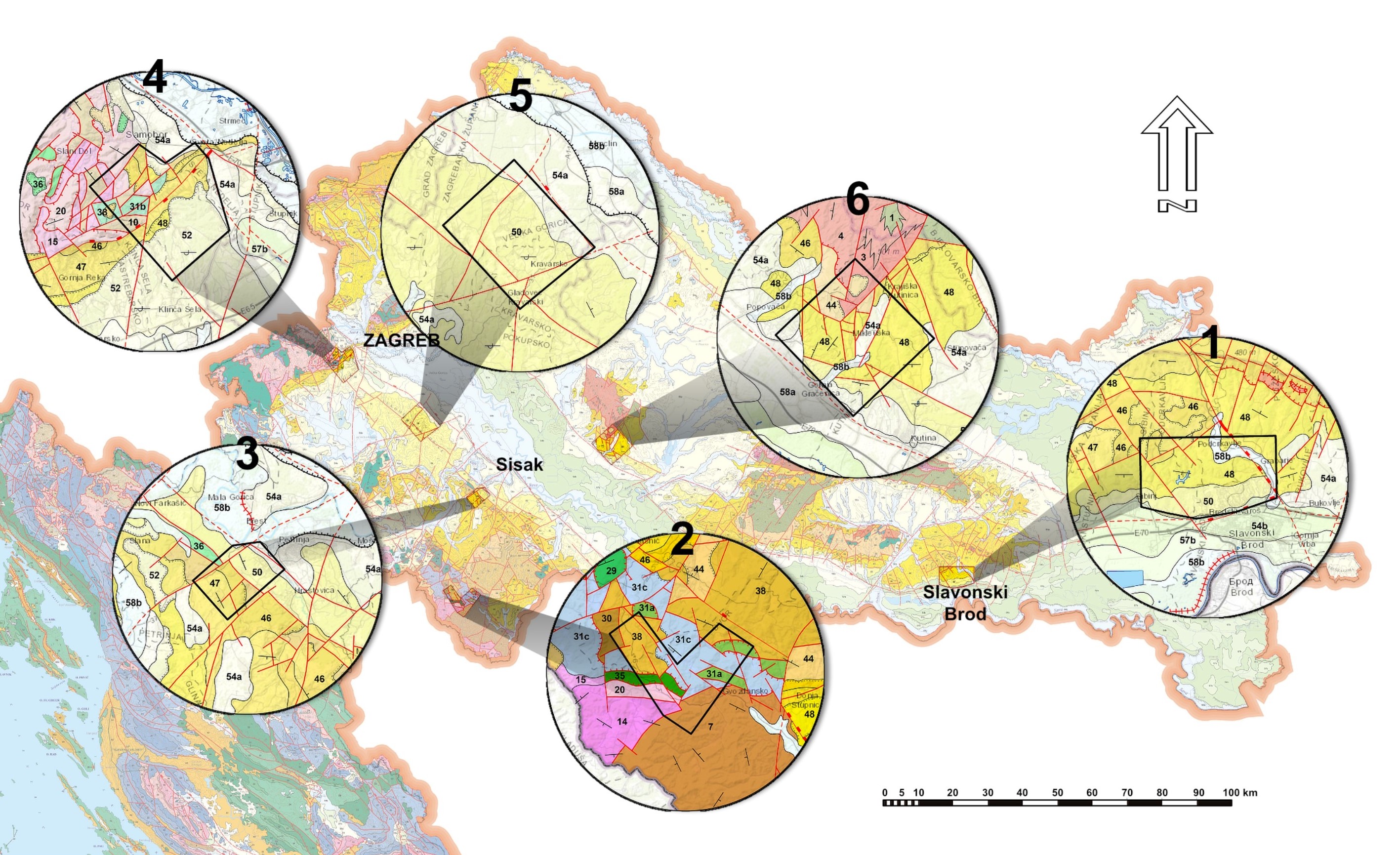
A preliminary analysis of landslide spatial distribution and their geometric characteristics is presented for the area of Slavonski Brod, located in the northeastern part of Croatia and belonging to the Pannonian Basin System. A landslide inventory for the study area of 55.1 km2 is accomplished for the first time, based on the visual interpretation of a high resolution LiDAR digital terrain model. In total, 854 landslide polygons are delineated, corresponding to an average density of 15.5 landslides per square kilometre. The average landslide area is 839 m2, and most of the landslides can be classified as small landslides (76 %). The spatial relationship between landslides and geological units is analysed and expressed as a landslide index. The Late Pannonian sands with silts and gravel interlayers and Pliocene clay, sands, gravels, and coal are determined as the units that are most susceptible to landslide processes. The majority of landslides (85 %) are concentrated within these two units, for which a detailed analysis is performed, determining the morphometric parameters (slope and relief) and drainage network. The parameters’ classes that create favourable preconditions to slope instabilities are defined, based on the landslide density within individual classes. Besides, the geometric characteristics of landslides (size and shape) within these two units are compared. The results serve as the basis for further investigations. They help to foresee the area of future landslides through landslide susceptibility maps, and offer a better understanding of the influence of fluvial-denudation and slope processes on recent landscape evolution and form.
Article Details
Issue
Section
Authors have copyright and publishing rights on all published manuscripts.
References
ARDIZZONE, F., CARDINALI, M., GALLI, M., GUZZETTI, F. & REICHENBACH, P. (2007): Identification and mapping of recent rainfall-induced landslides using elevation data collected by airbone Lidar.– Natural Hazards and Earth System Sciences, 7, 637–650. doi: 10.5194/nhess-7-637-2007
AVANIĆ, R., KOVAČIĆ, M., PAVELIĆ, D. & PEH, Z. (2018a): The Neogene of Hrvatsko zagorje.– In: TIBLJAŠ, D., HORVAT, M., TOMAŠIĆ, N., MILEUSNIĆ, M. & GRIZELJ, A. (eds.): 9th Mid-European Clay Conference, Conference book, Field Trip Guide book, Zagreb, 128–129.
AVANIĆ, R., ŠIMUNIĆ, AN. & PEH, Z. (2018b): Geology of the Croatian Zagorje Region.– In: RMAN, N., MARKOVIĆ, T. & BRENČIĆ, M. (eds.): 5. Slovenski geološki kongres, Post congress field trip book, Ljubljana, 35.
BARTELLETTI, C., GIANNECCHINI, R., D’AMATO AVANZI, G., GALANTI, Y. & MAZZALI, A. (2017): The influence of geological–morphological and land use settings on shallow landslides in the Pogliaschina T. basin (northern Apennines, Italy).– Journal of Maps, 13/2, 142–152. doi: 10.1080/17445647.2017.1279082
BELL, F.G. (2003.): Geological Hazards: Their Assessment, Avoidance and Mitigation.– Spoon Press, London, 648 p.
BELL, R., PETSCHKO, H., RÖHRS, M. & DIX, A. (2012): Assessment of landslide age, landslide persistence and human impact using airborne laser scanning digital terrain models.– Geografiska Annaler: Series A, Physical Geography, 94, 135–156. doi: 10.1111/j.1468‐0459.2012.00454.x
BERNAT GAZIBARA, S., KRKAČ, M. & MIHALIĆ ARBANAS, S. (2019): Landslide inventory mapping using LiDAR data in the City of Zagreb (Croatia).– Journal of Maps, 15/2, 773–779. doi: 10.1080/17445647.2019.1671906
BOGNAR, A. (1996): Tipovi klizišta u Republici Hrvatskoj i Republici Bosni i Hercegovini – geomorfološki i geoekološki aspekti. [The main types of landslides in the Republic of Croatia and Republic of Bosnia and Hercegovina – geomorphological and landscape ecological aspects – in Croatian].– Acta Geographica Croatica, 31, 27–39.
BOGNAR, A. (2001): Geomorfološka regionalizacija Hrvatske [Geomorphological regionalisation of Croatia – in Croatian].– Acta Geographica Croatica, 34, 7–29.
BPŽ, BRODSKO-POSAVSKA ŽUPANIJA (2019): Procjena rizika od velikih nesreća: Identifikacija, analiza, vrednovanje i obrada rizika od velikih nesreća za područje Brodsko-posavske županije [Risk assessment of major accidents: Identification, analysis, evaluation, and treatment of the major accident risk in the area of Brod-Posavina County – in Croatian]. –Brodsko-posavska županija, 301 p.
BURNS, W.J. & MADIN, I.P. (2009): Protocol for inventory mapping of landslide deposits from Light Detection and Ranging (LIDAR) imagery.– Special paper 42, Oregon Department of Geology and Mineral Industries, 30 p.
CHACON, J., IRIGARAY, C., FERNANDEZ, T. & EL HAMDOUNI, R. (2006): Engineering geology maps: landslides and geographical information systems.– Bulletin of Engineering Geology and the Environment, 65, 341–411. doi: 10.1007/s10064-006-0064-z
COCO, L. & BUCCOLINI, M. (2015): The Effect of Morphometry, Land-Use and Lithology on Landslides Susceptibility.– In: SCHWECKENDIEK, T., VAN TOL, A.F., PEREBOOM, D., VAN STAVEREN, M.TH. & COOLS, P.M.C.B.M. (eds): Geotechnical Safety and Risk V, IOS Press BV, 779–784. doi: 10.3233/978-1-61499-580-7-779
CONFORTI, M. & IETTO, F. (2020): Influence of Tectonics and Morphometric Features on the Landslide Distribution: A Case Study from the Mesima Basin (Calabria, South Italy).– Journal of Earth Science, 31, 393–409. doi: 10.1007/s12583-019-1231-z
CROZIER, M.J. (2010): Landslide geomorphology: An argument for recognition, with examples from New Zeland.– Geomorphology, 120/1–2, 3–15. doi: 10.1016/j.geomorph.2009.09.010
ČUBRILOVIĆ, P., PALAVESTRIĆ, LJ. & NIKOLIĆ, T (1967): Inženjerskogeološka karta SFR Jugoslavije u mjerilu 1:500000 [Engineering Geological Map of SFRY in scale 1:500.000 – in Croatian].– Savezni geološki zavod, Beograd.
DEMEK, J. & IGU (1972): Manual of Detailed Geomorphological Mapping.– IGU Comission on Geomorphological survey and mapping, Chechoslovak Academy of Science, Prague, 344 p.
DERRON, M.-H. & JABOYEDOFF, M. (2010): Preface “LIDAR and DEM techniques for landslides monitoring and characterization”.– Natural Hazards and Earth System Sciences, 10, 1877–1879. doi: 10.5194/nhess-10-1877-2010
FELL, R., COROMINAS, J., BONNARD, C., CASCINI, L., LEROI, E. & SAVAGE, W.Z. (2008): Guidelines for landslide susceptibility, hazard and risk zoning for land use planning.– Engineering geology, 102/3–4, 85–98. doi: 10.1016/j.enggeo.2008.03.022
FILJAK, R., PIKIJA, M., AVANIĆ, R., BAKRAČ, K. & MIKNIĆ, M. (2016): Osnovna geološka karta Republike Hrvatske mjerila 1 : 50000 – List Slavonska Požega 4 [Basic Geological Map of Republic of Croatia 1:50000, Slavonska Požega 4 sheet – in Croatian].– Hrvatski geološki institut, Zavod za geologiju, Zagreb.
GÖRÜM, T. (2019): Landslide recognition and mapping in a mixed forest environment from airborne LiDAR data.– Engineering Geology, 258, 105155. doi: 10.1016/j.enggeo.2019.105155
GUZZETTI, F., ARDIZZONE, F., CARDINALI, M., GALLI, M., REICHENBACH, P. & ROSSI, M. (2008): Distribution of landslides in the Upper Tiber River basin, central Italy.– Geomorphology, 96, 105–122. doi: 10.1016/j.geomorph.2007.07.015
GUZZETTI, F., MONDINI, A.C., CARDINALI, M., FIORUCCI, F., SANTANGELO, M. & CHANG, K.-T. (2012): Landslide inventory maps: New tools for an old problem.– Earth-Science Reviews, 112, 42–66. doi: 10.1016/j.earscirev.2012.02.001
HAQUE, U., BLUM, P., DA SILVA, P.F., ANDERSEN, P., PILZ, J., CHALOV, S.R., MALET, J.-P., AUFLIČ, M.J., ANDRES, N., POYIADJI, E., LAMAS, P.C., ZHANG, W., PESHEVSKI, I., PÉTURSSON, T.K., DOBREV, N., GARCÍA-DAVALILLO, J.C., HALKIA, M., FERRI, S., GAPRINDASHVILI, G., ENGSTRÖM, J. & KEELLINGS, D. (2016): Fatal landslides in Europe.– Landslides, 13/6, 1545–1554. doi: 10.1007/s10346-016-0689-3
HORVÁTH, F. & ROYDEN, L.H. (1981): Mechanism for the Formation of the Intra- Carpathian Basins: A Review.– Earth-Science Reviews, 3–4, 307–316.
JABOYEDOFF, M., OPPIKOFER, T., ABELLÁN, A., DERRON, M.-H., LOYE, A., METZGER, R. & PEDRAZZINI, A. (2012): Use of LIDAR in landslide investigations: a review.– Natural Hazards, 61, 5–28. doi: 10.1007/s11069-010-9634-2
JACOBS, L., DEWITTE, O., POESEN, J., MAES, J., MERTENS, K., SEKAJUGO, J. & KERVYN, M. (2016): Landslide characteristics and spatial distribution in the Rwenzori Mountains, Uganda.– Journal of African Earth Sciences, 134, 917–930. doi: 10.1016/j.jafrearsci.2016.05.013
JAGODNIK, P., JAGODNIK, V., ARBANAS, Ž. & MIHALIĆ ARBANAS, Ž. (2020): Landslide types in the Slani Potok gully, Croatia.– Geologia Croatica, 73/1, 13–28. doi: 10.4154/gc.2020.04
KEATON, J.R. & DEGRAFF, J.V. (1996): Surface observation and geologic mapping.- In: TURNER, A.K. & SCHUSTER, R.L. (eds.): Landslides – Investigation and Mitigation, National Research Council, Washington, DC, 178–230.
KOVAČIĆ, M., HORVAT, M., PIKIJA, M. & SLOVENEC, Da. (2011): Composition and provenance of Neogene sedimentary rocks of Dilj gora Mt. (south Pannonian Basin, Croatia).– Geologia Croatica, 64/2, 121–132. doi: 10.4154/GC.2011.10
KRAUS, D. (2014): An open-source add-in for the Microsoft Excel® spreadsheet software. Downloaded from https://www.xltoolbox.net/ (21.09.2020)
LUPIANO, V., RAGO, V., TERRANOVA, O.G. & IOVINE, G. (2019): Landslide inventory and main geomorphological features affecting slope stability in the Picentino river basin (Campania, southern Italy).– Journal of Maps, 15/2, 131–141. doi: 10.1080/17445647.2018.1563836
MALAMUD, B.D., TURCOTTE, D.L., GUZZETTI, F. & REICHENBACH, P. (2004): Landslide inventories and their statistical properties.– Earth Surface Processes and Landforms, 29, 687–711. doi: 10.1002/esp.1064
MCCALPIN, J. (1984): Preliminary age classification of landslides for inventory mapping.– Proceedings of the Annual Symposium on Engineering Geology and Soil Engineering, 21, Moscow, Idaho, 99–120.
MIHALIĆ ARBANAS, S., KRKAČ, M. & BERNAT, S. (2016): Application of advanced technologies in landslide research in the area of the City of Zagreb (Croatia, Europe).– Geologia Croatica, 69/2, 231–243. doi: 10.4154/gc.2016.18
MIHALIĆ ARBANAS, S., SEČANJ, M., BERNAT GAZIBARA, S., KRKAČ, M., BEGIĆ, H., DŽINO, A., ZEKAN, S. & ARBANAS, Ž. (2017): Landslides in the Dinarides and Pannonian Basin – from the largest historical and recent landslides in Croatia to catastrophic landslides caused by Cyclone Tamara (2014) in Bosnia and Herzegovina.– Landslides, 14, 1861–1876. doi: 10.1007/s10346-017-0880-1
PAVELIĆ, D. & KOVAČIĆ, M. (2018): Sedimentology and stratigraphy of the Neogene rift-type North Croatian Basin (Pannonian Basin System, Croatia): A review.– Marine and Petroleum Geology, 91, 455–469. doi: 10.1016/j.marpetgeo.2018.01.026
PAWLUSZEK, K. (2019): Landslide features identification and morphology investigation using high-resolution DEM derivatives.– Natural Hazards, 96, 311–330. doi: 10.1007/s11069-018-3543-1
PETSCHKO, H., BELL, R. & GLADE, T. (2014): Relative Age Estimation at Landslide Mapping on LiDAR Derivatives: Revealing the Applicability of Land Cover Data in Statistical Susceptibility Modelling.– In: SASSA, K., CANUTI, P. & YIN, Y. (eds.): Landslide Science for a Safer Geoenvironment, Springer, 337–343. doi: 10.1007/978-3-319-05050-53
PETSCHKO, H., BELL, R. & GLADE, T. (2016): Effectiveness of visually analyzing LiDAR DTM derivatives for earth and debris slide inventory mapping for statistical susceptibility modelling.– Landslides, 13, 857–872. doi: 10.1007/s10346-015-0622-1
REICHENBACH, P., ROSSI, M., MALAMUD, B.D., MIHIR, M. & GUZZETI, F. (2018): A review of statistically-based landslide susceptibility models.– Earth- Science Reviews, 180, 60–91. doi: 10.1016/j.earscirev.2018.03.001
ROYDEN, L.H. (1988): Late Cenozoic Tectonics of the Pannonian Basin System.– In: ROYDEN, L.H. & HORVATH, I.F. (eds.): The Pannonian Basin: A study in Basin Evolution. AAPG Memoir, 45, 27–48. doi: 10.1306/M45474C3
SCAIONI, M., LONGONI, L., MELILLO, V. & PAPINI, M. (2014): Remote Sensing for Landslide Investigations: An Overview of Recent Achievements and Perspectives.– Remote Sensing, 6/10, 9600–9652. doi: 10.3390/rs6109600
SCHULZ, W.H. (2004): Landslides mapped using LIDAR imagery, Seattle, Washington. U.S. Geological Survey Open–File Report 2004–1396, 11 p.
SOETERS, R. & VAN WESTEN, C.J. (1996): Slope instability recognition, analysis, and zonation.– In: TURNER, A.K. & SCHUSTER, R.L. (eds.): Landslides: Investigation and Mitigation. Transportation Research Board, 247, National Academy Press: Washington DC, 129–177.
STRAHLER, A.N. (1956): Quantitative Slope Analysis.– Geological Society of America Bulletin, 67, 571–596. doi: 10.1130/0016-7606(1956)67%5B571:QSA%5D20.CO;2
ŠESTANOVIĆ, S. (2001): Osnove geologije i petrografije [Fundamentals of geology and petrography – in Croatian].– Sveučilište u Splitu, Građevinski fakultet, 236 p.
ŠPARICA, M., JURIŠA, J., CRNKO, J., ŠIMUNIĆ, AN., JOVANOVIĆ, Č. & ŽIVANOVIĆ, D. (1979a): Osnovna geološka karta SFRJ 1:100.000, list Nova Kapela [Basic Geological Map of SFRY 1:100.000, Nova Kapela sheet – in Croatian].– Institut za geološka istraživanja, Zagreb, Geološki zavod, Sarajevo, Savezni geološki zavod, Beograd.
ŠPARICA, M., JURIŠA, J., CRNKO, J., ŠIMUNIĆ, AN., JOVANOVIĆ, Č. & ŽIVANOVIĆ, D. (1979b): Osnovna geološka karta SFRJ 1:100.000. Tumač za list Nova Kapela [Basic Geological Map of SFRY 1:100000, Geology of the Nova Kapela sheet – in Croatian].– Institut za geološka istraživanja, Zagreb, Geološki zavod, Sarajevo, Savezni geološki zavod, Beograd.
ŠPARICA, M. (1986): Osnovna geološka karta SFRJ 1:100.000, list Slavonski Brod [Basic Geological Map of SFRY 1:100.000, Slavonski Brod sheet – in Croatian].– Geološki zavod, Zagreb, Savezni geološki zavod, Beograd.
ŠPARICA, M., BUZALJKO, R. & MOJIĆEVIĆ, M. (1987): Osnovna geološka karta SFRJ 1:100.000. Tumač za list Slavonski Brod [Basic Geological Map of SFRY 1:100.000, Geology of the Nova Kapela sheet – in Croatian].- Institut za geološka istraživanja, Zagreb, Geološki zavod, Sarajevo, Savezni geološki zavod, Beograd.
TAROLLI, P. (2014): High-resolution topography for understanding Earth surface processes: opportunities and challenges.– Geomorphology, 216, 295–312. doi: 10.1016/j.geomorph.2014.03.008
TIAN, Y., XU, C., CHEN, J., ZHOU, Q. & SHEN, L. (2017): Geometrical characteristics of earthquake-induced landslides and correlations with control factors: a case study of the 2013 Minxian, Gansu, China, Mw 5.9 event.– Landslides, 14, 1915–1927. doi: 10.1007/s10346-017-0835-6
TOŠEVSKI, A. (2013): Inventar klizišta u slivu rijeke Dubračine [Slide inventory in Dubracina river basin – in Croatian].– Rudarsko-geološko-naftni zbornik, 27, 1–16.
VAN DEN EECKHAUT, M., POESEN, J., VERSTRAETEN, G., VANACKER, V., NYSSEN, J., MOEYERSONS, J., VAN BEEK, L.P.H. & VANDEKERCKHOVE, L. (2007): Use of LIDAR-derived images for mapping old landslides under forest.– Earth Surface Processes and Landforms, 32, 754–769. doi: 10.1002/esp.1417
VAN WESTEN, C.J. (2000): The modelling of landslide hazards using GIS.– Surveys in Geophysics, 21, 241–255.
VAN WESTEN, C.J., CASTELLANOS, E. & KURIAKOSE, S.L. (2008): Spatial data for landslide susceptibility, hazard, and vulnerability assessment: An overview.– Engineering Geology, 102/3–4, 112–131. doi: 10.1016/j.enggeo.2008.03.010
VARNES, D.J. & IAEG (1984): Landslide hazard zonation: a review of principles and practice.– IAEG Commission on Landslides and Other Mass Movements, Natural Hazards 3, UNESCO, Paris, 63 p.
ZANINOVIĆ, K., GAJIĆ-ČAPKA, M., PERČEC TADIĆ, M., VUČETIĆ, M., MILKOVIĆ, J., BAJIĆ, A., CINDRIĆ, K., CVITAN, L., KATUŠIN, Z., KAUČIĆ, D., LIKSO, T., LONČAR, E., LONČAR, Ž., MIHAJLOVIĆ, D., PANDŽIĆ, K., PATARČIĆ, M., SRNEC, L. & VUČETIĆ, V. (2008): Klimatski atlas Hrvatske: 1961-1990, 1971-2000 [Climate atlas of Croatia: 1961-1990, 1971-2000 – in Croatian].– Državni hidrometeorološki zavod, Zagreb, 200 p.