
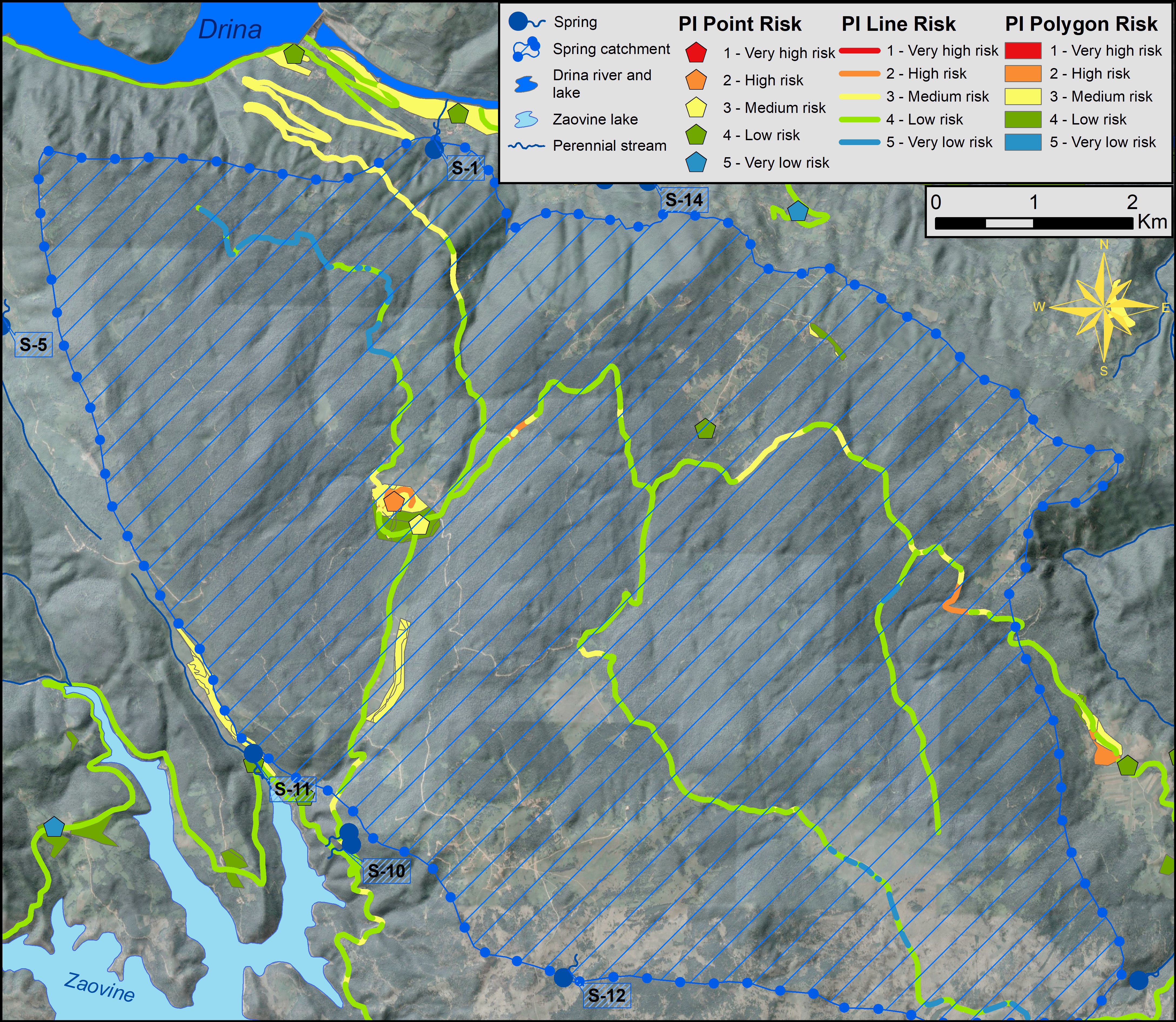
This figure shows the groundwater contamination risk map of the Perućac spring catchment area located in the National Park Tara (Eastern Serbia). The risk map was obtained using a PI groundwater vulnerability map and a map of existing hazards in the catchment area – for more information, see the paper by Živanović et al. (this Vol.)
Published: 2022-10-26